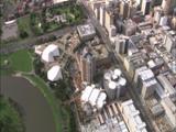
For those who are geospatially inclined, I just stumbled upon this neat little mapping tool that allows you to see an outline of one part of the world overlaid on another part. You can create a unique URL for all of your creations.
For example, I just did an outline of Manhattan Island and overlaid it on Adelaide. It really gives you a sense of scale. Central Park alone is around the distance from South Tce to Fitzroy Tce.
http://mapfrappe.com/?show=10280
Enjoy as you please.
Neat mapping tool
-
Maximus

- Legendary Member!
- Posts: 630
- Joined: Wed Feb 20, 2008 12:05 pm
- Location: The Bush Capital (Canberra)
Neat mapping tool
It's = it is; its = everything else.
You're = you are; your = belongs to.
Than = comparative ("bigger than"); then = next.
You're = you are; your = belongs to.
Than = comparative ("bigger than"); then = next.
-
monotonehell

- VIP Member

- Posts: 5466
- Joined: Fri Feb 01, 2008 12:10 am
- Location: Adelaide, East End.
- Contact:
Re: Neat mapping tool
Similarly, Google's just put together satellite time lapses from 1984 to 2012. You can watch Adelaide sprawl here: http://earthengine.google.org/#timelaps ... Lng&t=2.25
Keep Adelaide Weird
Who is online
Users browsing this forum: Bing [Bot] and 37 guests